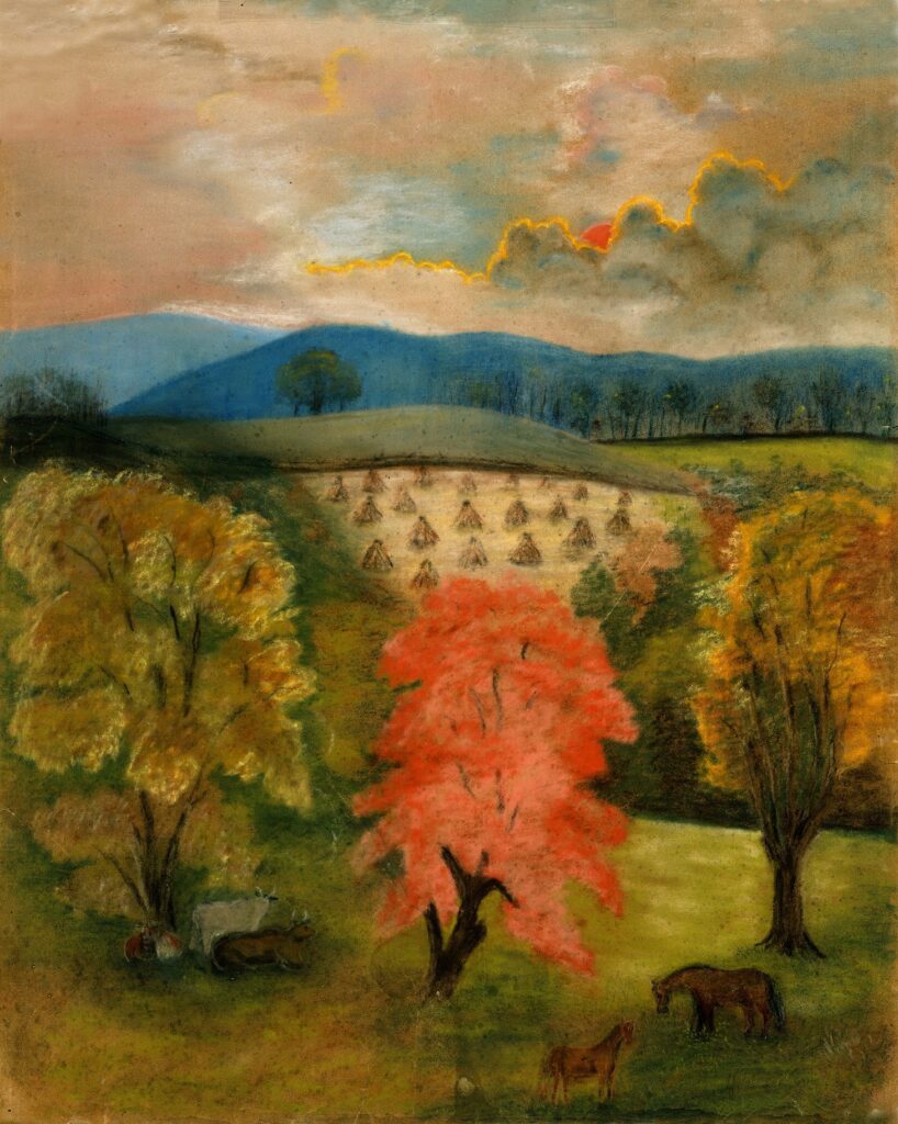
The Phillips Farm is a 144 acre beautifully conserved area central to the Waterford National Historic Landmark. The rolling vitas of farmland surrounding Waterford have been part of the Village’s history for hundreds of years. Walking the Village today, you can see rural field patterns that would be very familiar to villagers in the nineteenth and early twentieth century.
Since 2003, the Waterford Foundation have worked diligently to conserve the Phillips Farm and the historic and natural resources on the property. We welcome visitors and ask their help in preserving this special place. Learn how you can come out and explore Phillips Farm and Waterford on our walking trails, as well as the Phillips Farm conservation story, and the current project underway to conserve it below!
About the Phillips Farm
The current parcel known as the Phillips Farm is a portion of the 220 acre parcel collected by Thomas Phillips sometime between 1798 and 1832. He was a member of the Society of Friends (Quaker) and operated the tannery with fellow Quaker Asa Moore. After Moore passed away, Phillips acquired his mill (located on the Waterford Mill property) and associated acreage. Phillips would sell the mill in 1832, but would keep some of the associated acreage to add to his growing farm. After his death, Phillips’ descendants continued to farm on the property for 150 years. Products produced during its time of operation include dairy and beef, pork, hay, corn, wheat, honey, and wool.
In 2003, the Phillips Farm, 144 acres of farmland southwest of the village, was slated to be subdivided into multiple lots. Had that development occurred, destroying the pastoral viewshed beyond the South Fork of the Catoctin Creek, Waterford’s National Historic Landmark status would have been seriously jeopardized.
The Waterford Foundation and its many supporters secured nearly $4 million to purchase the Phillips Farm. It is now preserved as open space in agricultural use forever, through a conservation easement held by the Virginia Outdoors Foundation. The Phillips Farm now hosts an agricultural hayed area that is tended by a local farmer, hiking trails, and and conserved meadow and streambank.
As stated in the Phillips Farm Land Use and Management Plan (Management Plan), which was updated and approved by the Board of Directors in February 2021, the vision statement for the Phillips Farm property is “The Waterford Foundation is committed to being an exemplary steward of the Phillips Farm by protecting it as an important contributing element of the Waterford National Historic Landmark District and Loudoun County’s Waterford Historic & Cultural Conservation District and by providing access to the farm for recreational, educational, and agricultural use.” Also as stated in the Management Plan, the goal for the Phillips Farm is “The Foundation will protect the agricultural, natural, historic, and cultural resources of the farm while providing opportunities for the public to engage with the farm.”
Conservation on the Phillips Farm
The opportunities on the Farm to further our understanding of this region’s agrarian past are numerous and fascinating. Protection of the site’s natural resources and agricultural use of the Farm are requirements of the conservation easement. Much of the Farm is leased to a local farmer for haymaking.
The Waterford Foundation has released a Phillips Farm Management and Land Use Plan carefully developed to ensure responsible stewardship of the Farm in accordance with the requirements of the conservation easement. (In 2010 the Virginia Department of Forestry recognized this work by designating the Farm a Certified Stewardship Forest.) Protection of the site’s natural resources and support of agricultural uses of the Farm, key requirements of the easement, are highlighted. So is its historic significance to the area. The plan also contains directions to the Farm, an Access Policy, and Rules of the Trail for visitors. A copy of the complete plan is available upon request from the Foundation office.
Educational programs for historic preservation and natural resources protection are underway on the Phillips Farm. Habitat restoration (the Farm is a Monarch Butterfly Waystation), forestry management, water quality monitoring, and riparian buffer planting are ongoing efforts coordinated by the Phillips Farm Committee. The Foundation partners with the Loudoun Wildlife Conservancy on several of these programs. Bird and butterfly counts and bluebird nest boxes provide additional educational opportunities. An interpretive trail provides visitors with an opportunity to study the history and natural beauty of the area.
Current Project Highlights:
Invasive Plant Management
Poison Hemlock
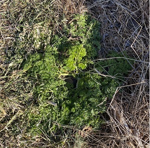
The Waterford Foundation’s privilege of managing the Phillips Farm, with its important natural and cultural resources, comes with challenges, including controlling invasive species. The presence of poison hemlock has been confirmed on approximately 11-acres of the Phillips Farm. This invasive plant is quite toxic, and while it has been present in the US since the 1800s, distribution of the plant has increased significantly in the past decade. The Phillips Farm Subcommittee mapped the presence of plants that were visible this spring and locations were confirmed by the Loudoun County Extension Service.
To manage this difficult invasive plant, the Waterford Foundation has retained NatureWorks to initiate application of an herbicide, approved by EPA for application in and around aquatic environments to the affected areas. Treatments in 2022 made a significant impact in the distribution of the hemlock on the Farm; however, further treatment will be needed for the next several years to fully control the invasive poison hemlock. Treatments continued in 2023 and 2024. At the end of 2024, there was no new growth noticed. The poison hemlock looks to diminish in growth in 2025 after the first spraying.
While the Foundation has rarely used herbicides on the farm, the approved management plan for the Phillips Farm permits the use of herbicides when absolutely necessary. Out of concern for public health and for the potential for poison hemlock to continue to spread, the Foundation elected to utilize herbicide as part of an integrated approach to invasive management that will also include mowing and cutting of flower heads before they seed and promoting the establishment of native plant species.
Mile-a-Minute Vine and Autumn Olive
Two other invasives that are growing throughout the farm in places that have been cleared of poison hemlock is mile-a-minute vine and autumn olive. Mile-a-minute vine is an invasive species that got its name from being a fast growing vine that forms dense mats that crowd out and kill native species. Autumn olive is another vine that also grows mostly on trees to block out the light from native species.
Both are non-toxic plants that can be pulled by hand. The Open Spaces Subcommittee in partnership with the Waterford Citizens Association and local scout groups schedule regular cleanups targeting these plants before they grow berries in the fall.
Water Quality
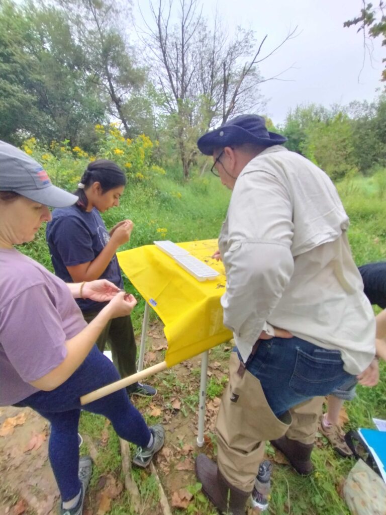
The Waterford Foundation, in partnership with the Loudoun Wildlife Conservancy, conducts yearly macroinvertebrate stream monitoring in the fall and spring. There are two sites on the Phillips Farm for stream monitoring- one on Ball’s Run and the other by the Mill.
Along with that, the Foundation also conducts testing of the oxygen and e-coli counts of the South Fork of the Catoctin Creek. We are also looking into starting to conduct Salt Watch monitoring.
Riparian Buffers
Riparian buffers are native trees planted along a river or stream to help mitigate erosion and other deterioration of the streambank. In December 2023 in partnership with the Piedmont Environmental Council and Loudoun Soil and Water Conservation District, six species of native plants (river birch, white oak, willow oak, persimmon, and arrowwood viburnum) were planted along Ball’s Run on the Schooley Mill property as a riparian buffer. These trees are continually monitored for growth. The Foundation, along with the Piedmont Environmental Council, are looking into areas on the Phillips Farm that are candidates for riparian buffers.