History
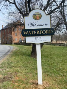
Well into the 20th century, most Americans lived and worked on farms or in small towns much like Waterford. Very few of these places remain much as they were with several intact historical buildings and homes that have been preserved and Waterford, miraculously, is one that has.
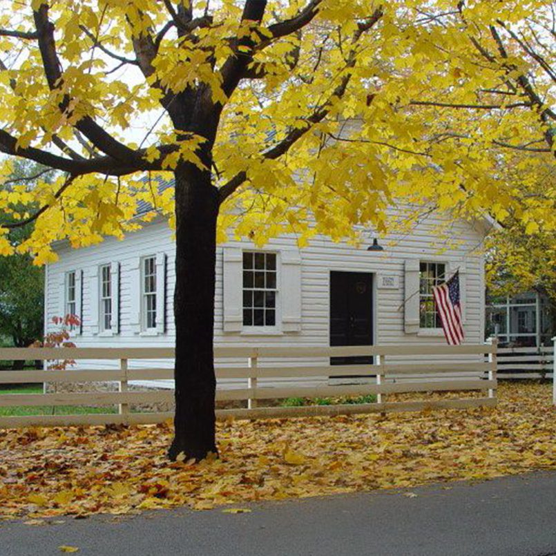
Second Street School
In 1867 the first public school for Waterford’s African American community was built at the corner of Fairfax Street and Second Street. The Second Street School is one of the first one-room schoolhouses for black children in Loudoun County and is one of the earliest African-American houses of worship. The simple one-room frame school on Second Street was built just two years after the Civil War ended and today, it is used for our Second Street School Living History program. Read more
Philips Farm Trail Guide
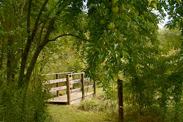
Phillips Farm Self-Guided Trail Walking Tour is an interpretive guide that goes through the Phillips Farm detailing the natural and cultural history on the property, with numbered posts corresponding to points of interest. Follow the marked trail to learn about the history, geography, habitat restoration and monarch butterfly waystation found on site. As you hike the trail, you will understand the relationship of the Farm to the growth of the village, and why this property is so important to Waterford’s status as one of America’s National Historic Landmarks. Read more about the Philips Farm Self-Guided Trail Walking Tour Here!
This trail project was funded by a generous grant from the Peter M. Howard Memorial Fund through the Piedmont Community Foundation and the volunteer efforts of Rob Hale, John Souders, and Committee Chair Mimi Westervelt.
YouTube Channel
Did you know we have our very own YouTube Channel? During our Give Choose Campaign this year, Mr. Brett Walker provided us with some very fun videos that we have shared with you all through our YouTube Channel. These videos are an example of one type of socially distant education outreach we will be working on in the days and months to come. Make sure you subscribe to updates from our channel on YouTube to see new videos as they are released! Click Here to view our YouTube Channel!
African American Experience Interactive
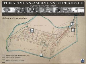
Learn about the African American experience in Waterford through this interactive map featuring sites in Waterford that are significant to the African American community.
On the map, click on one of these five sites to learn more: the Second Street School, the John Wesley Church, Union Cemetery, the Claggett House and the Old Mill. Three of the sites feature a short video and interactive content, while all five sites feature a gallery of historic and modern photographs. Watch videos featuring former students and Waterford descendants discuss their experiences in Waterford in the 20th century, and learn about the Mill and its connection to Waterford’s African-American community. See historic photographs and meet members of the John Wesley church congregation of 1910. Take a short quiz at the Second Street School to see if you know what students in 1880 were expected to know.
Click Here to get started!
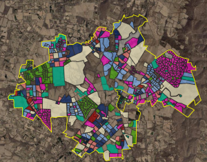
Dashboard Map of Western Loudoun Development, 1950-2020
Dashboard Map of Western Loudoun Development
Explore the timeline of development in Loudoun County in this dashboard map built on GIS (geographic information system) mapping information. This dashboard was created in the spring of 2020 by then high school student Nick Spokes as a class project. The dashboard is organized into three tabs: Percent Development in Loudoun’s Historic Towns, Percent Development After 1949 in Loudoun’s Historic Towns Adding Parcels, and Waterford Area Development Over Time. Click the map views for more information, zoom in and out, and pan around with your mouse. Don’t miss additional information along the left sidebar.